News
How Does California's San Andreas Fault Move?
Hollywood is yet again pushing the boundaries of reality while injecting a smidgen of scientific feasibility and fear with the film San Andreas, a disaster-drama starring Dwayne Johnson about a magnitude 9 earthquake triggered by the San Andreas fault. Earthquakes are a real-life threat, and Patt Morrison, a columnist for the Los Angeles Times, said he hopes the film will make Californians take earthquake preparation seriously. Because, in reality, how the San Andreas fault moves is pretty important, even if the science behind its movement isn't something we'd usually research heavily on a Friday night. So, I've saved everyone a bit of time and broke it down to the basics. (Next step, survival preparation — Dwayne Johnson-style.)
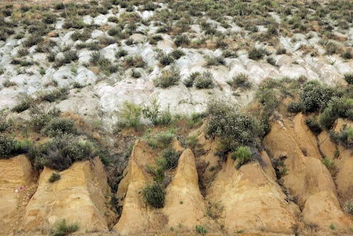
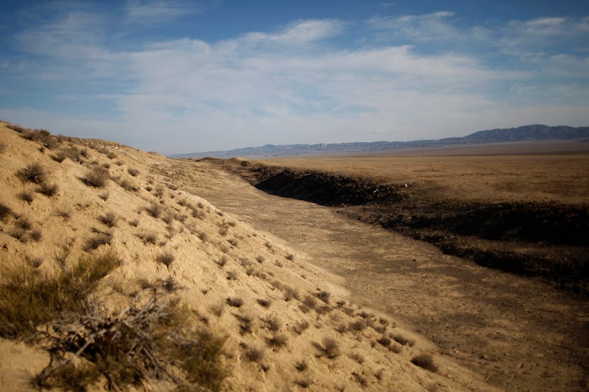
If we jump back in time to ninth grade environmental science, we know that the earth's crust is broken into a series of plates. The plates move very slowly, and two of those moving plates meet in western California — that meeting is called the San Andreas fault. The entire San Andreas fault system is more than 800 miles long and extends as deep as 10 miles within the Earth, according to the U.S. Geological Survey. The main reason behind the plates' movement is the theory of plate tectonics, which says that convection (movement caused by the transfer of energy, in this case heat energy) is occurring in the earth's mantle. The heat behind that convection is caused by rising hot material in the earth's core, according to Live Science. There are three major types of tectonic movements: spreading apart at mid-ocean ridges, a pushing together of two plates that causes one to sink downward (subduction zones), and then slip-sliding, transform margins like the San Andreas fault, according to Live Science.
The two sides of the fault slip-slid against each other at different rates. The west side of the fault, called the Pacific Plate, where the majority of California's population sits (Ahh!), is headed northwest at 3 inches (8 centimeters) per year, according to Live Science. The opposite North America Plate, which holds the rest of North America, is heading south at about one inch (2.3 centimeters) per year. Bye, California! I'm just kidding. But really.
Movements along the fault differ from place to place. Everything from Parkfield to Hollister is "creeping," while other sections are "locked." These locked sections store up a ton of energy, like springs, or like you during bitter winters. When they finally let loose, they quickly and violently jerk past each other and cause an earthquake. There have been two major earthquakes along the fault — one in 1857 and one in 1906. The U.S. Geological Survey estimates that an earthquake similar to the magnitude 7.9 that hit in 1857 would destroy half of the buildings in Los Angeles, take out the city's water supply, and injure more than 50,000 people. The 1906 magnitude 7.9 (an 8.3 on the Richter scale) earthquake killed 700 people, triggered a deadly fire, and fractured the Earth's surface along a 250-mile length from San Juan Bautista to Cape Mendocino, according to Live Science.
Scientists do think the next "Big One," or the next magnitude 8 or greater earthquake, could happen in southern California, but they're not quite sure when, according to a website that tracks the San Andreas fault. Hold on to your surfboards, California, 'cause you're moving (by at least three inches a year) whether you like it or not.
Images: Getty Images (2)
