Life
Everything You Know About Geography Is Wrong

Maps are deceptively complicated things — after all, they require someone to take a 3D object (aka the Earth) and represent it in only two dimensions — and often, this means that the relative sizes of places gets distorted. But here to help correct the geographic misconceptions that come with that is the True Size Map. Apparently our whole idea of how the world is proportioned is totally screwed up — and while it's true that that's not really our fault, we should probably still try to fix it. There's no excuse for ignorance in the Age of Information, right?
We tend to take maps for granted, especially since Google these days can instantly show us a map of any spot on Earth with enough detail that you can literally see your own house. And with that level of detail, it's no wonder that we just assume that those maps are accurate. But in truth, Google maps (and pretty much every other map out there) uses a Mercator Projection map, which is common but also not the best. Because Mercator was developed in the 16th century for use by sailors, it tries to keep the lines of latitude and longitude straight for easy navigation — which means that the further you get from the equator, the more stretched out everything is and the bigger all the landmasses look.
Also, yes you did hear that right — the same advanced technology that brought you Street View and can figure out your estimated time of arrival via public transit does, in fact, still use a map developed in the the 1500s. Why do you ask?
The point, though, is that this makes it hard to visualize how big everything is. Here to fix that: The True Size Map. It's an online tool that lets you select countries from a Mercator Projection map and move them around to see how they grow or shrink based on how close they are to the equator, and see how they compare, size-wise, to countries at different latitudes. For instance:
Ghana
Here we have the country of Ghana in West Africa.
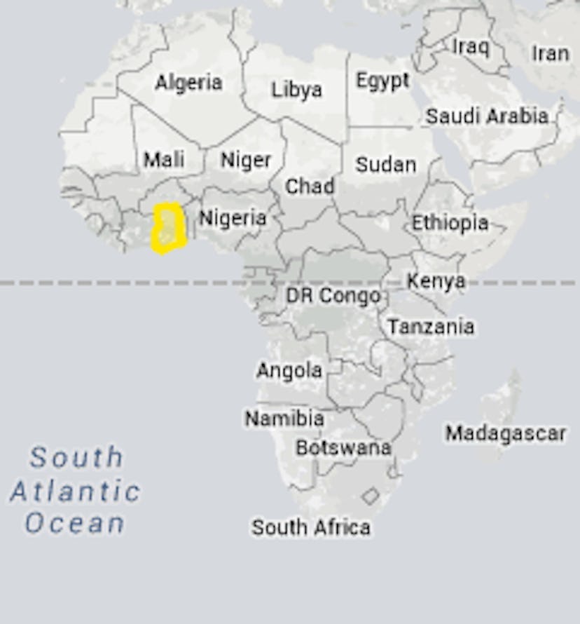
It looks tiny, especially compared to nearby nations like Nigeria or Mali. But it's also close to the equator, so let's see what happens if we drag it closer to, say, the United States.

Turns out, Ghana is bigger than the state of Illinois, one of the United States' most populous states. It's roughly the size of New England. It's not that tiny after all.

What about some other countries? Well, here's a look at Russia.
Russia
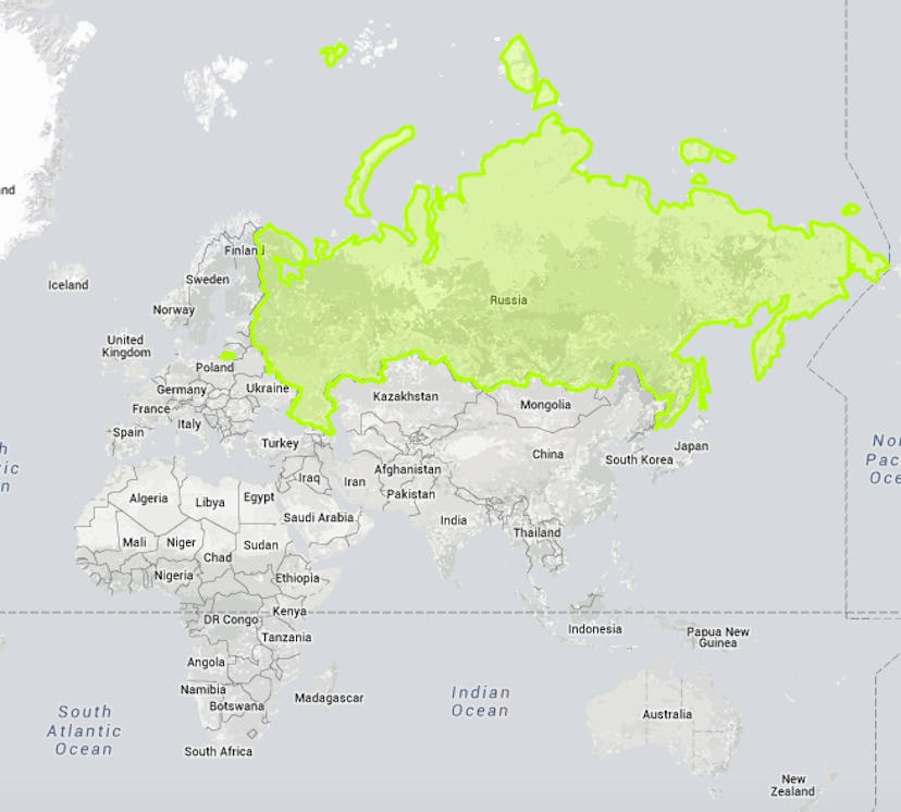
It looks huge, right? And it is the largest country on Earth — that much is true. But what if it weren't so far north?
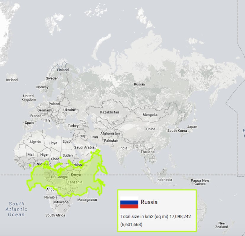
Turns out if you drag Russia down to the equator... well, it's still pretty huge; 6 million square miles is big any way you slice it. But it's also no longer the imposing behemoth towering over the rest of the globe we usually think of it as.
Democratic Republic of the Congo

The DRC is bigger than most African nations, so it doesn't exactly look tiny on the map like Ghana does, but the country is also located right across the equator. What would it look like if it were a bit further away?
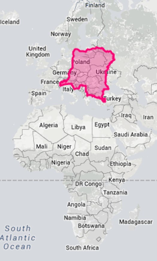
Turns out the DRC is about the size of all of Eastern Europe. You can see what a size boost a few degrees in latitude is.
Germany
Instead of dragging things over to Europe, though, let's drag one of Europe's decently sized countries down. Like, say, Germany.
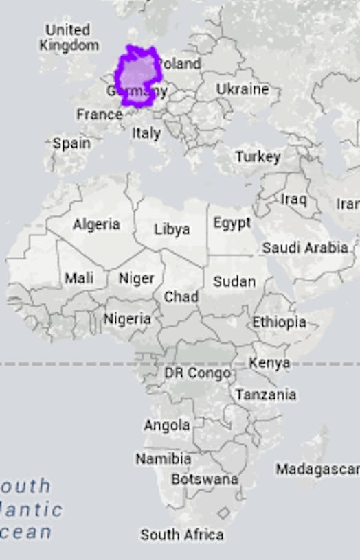
Germany is decently large for a European country, though we all know that that's not saying a whole lot. But it turns out that's even more true than you might realize. This is how big Germany would appear if it were near the equator.

Once again, the DRC is bigger than you think it is.
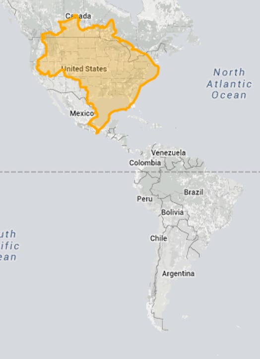
Brazil
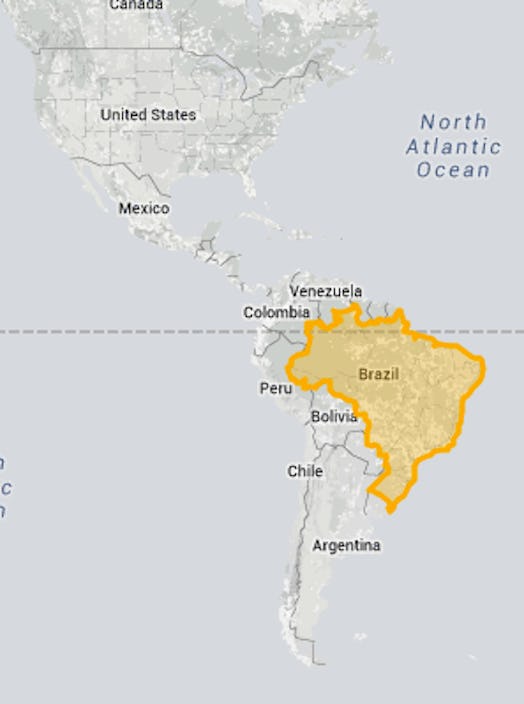
Brazil is the largest country in South American, but it also happens to be pretty close to the equator. How would it look if it were, say, at the same latitude as the United States?
Greenland
This one is a classic. Greenland is possibly the most distorted of all the countries on the map. Russia might be able to give it a run for it's money, but Russia also has the distinction of being actually huge. Greenland, on the other hand, looks as big as — if not bigger than — South America.
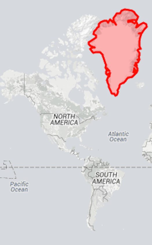
In reality?

In reality Greenland is not even as big as Argentina. Sorry, Greenland.
You can pick your own countries to compare at the True Size Map here. I recommend also checking out Alaska. It's not a country, but it's fascinating.
Images: Wikipedia Commons; Giphy; True Size Map (13)
